We are literally watching a slow-motion apocalyptic event play out right in front of our eyes, but most people in the general population don’t seem too concerned even though we are being warned that this apocalyptic event could cause trillions of dollars in economic losses. Large numbers of fish are being cooked to death, unprecedented wildfires are ripping across the United States and Europe, severe drought is greatly harming agricultural production in many areas, and the northern hemisphere is being slammed by one crazy heatwave after another. Yeah, a lot of people out there may be able to ignore what is going on outside by sitting in their air-conditioned homes, but the truth is that what is happening to us is going to cause a tremendous amount of pain for the whole world for an extended period of time.
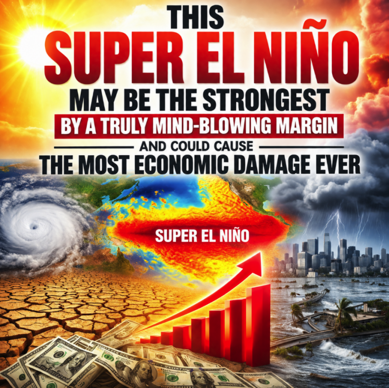
The Super El Niño that we are currently experiencing is setting new water temperature records in the Pacific Ocean on a daily basis, and one expert is warning that it appears that “it may end up the strongest by a truly mind-blowing margin”…
The strengthening El Niño – a natural warming of seawater that influences weather around the planet – is setting daily warm water records.
It’s not only “very likely to be the strongest event since reliable records began – it may end up the strongest by a truly mind-blowing margin,” Zeke Hausfather, a research scientist at Berkeley Earth, wrote in a post for The Climate Brink, a Substack blog, earlier in July.
It remains to be seen what this will mean for the world’s weather over the next 12 to 18 months, but climate scientists say El Niño’s effects on global temperatures will increase the chances that 2026 could be the warmest year on record, and make it likely that 2027 will be the warmest.
The droughts caused by the Super El Niño of 1877-1878 resulted in famines that killed tens of millions of people.
So if this Super El Niño will be stronger than that Super El Niño “by a truly mind-blowing margin”, what will that mean for impoverished nations all over the globe?
Prior to the war with Iran, the number of people around the globe suffering from acute food insecurity was already at the highest level ever recorded.
How bad will things get in the months ahead?
This Super El Niño just started, and we are already setting records.
Sea surface temperatures in the equatorial waters of the Pacific have never been this hot in July.
We truly are in unprecedented territory, and scientists are extremely concerned about what is coming next.
In fact, a Dartmouth professor is telling us that this could be “the costliest El Niño on record”…
Because of its influence on hydrologic cycles, El Niño can bring catastrophic floods to some regions but severe drought and wildfires to others. It can also disrupt fisheries and food production and bring about trillions of dollars in economic losses.
“The current forecasts imply this could be the costliest El Niño on record,” Justin Mankin, a Dartmouth geography associate professor who studies El Niño’s economic impacts, recently told USA TODAY by email.
Trillions of dollars in economic losses is nothing to laugh at.
If a worst-case scenario materializes, we could potentially be facing tens of trillions of dollars in economic losses from this Super El Niño.
We won’t know exactly how bad this event will be until it is over, because we have never seen anything like this before.
At this moment, the heartland of America is being absolutely baked by the third giant “heat dome” to strike the U.S. over the last month…
About 70 million people in the US are set to face excessive heat advisories as dangerously hot temperatures scorch much of the country’s southern and central states.
The third major “heat dome” event to hit the US in the past month is gathering strength over the weekend, spanning a vast swathe of the country, from the Gulf of Mexico coast to the Great Plains and the midwest.
Temperatures of 95-105F (35-40C) are expected, with some areas of the south-western US desert potentially reaching 120F (48C). The elevated heat is expected to linger into the coming week, held in place by the heat dome, which is when a high-pressure atmospheric system acts as a sort of lid, trapping heat in place over a region for days or even weeks.
Not too long ago, “heat dome” events were considered to be quite rare.
Now we are getting slammed by one almost every week.
It isn’t supposed to get up to 108 degrees in Nebraska, and it isn’t supposed to get up to 114 degrees in Nevada…
Places under a National Weather Service extreme heat warning included western Nebraska, where temperatures Saturday and Sunday were forecast to reach 108F.
The region’s heat was forecast to continue through the week, with temperatures topping 100F even in normally moderate areas of Montana and Wyoming.
Las Vegas was also expected to see near record-breaking highs. On Saturday, when temperatures reached around 114F in the valley, HVAC repair technician Kristian ‘Flaco’ Santos spent hours outside fixing air conditioning units.
And guess what?
A lot more heat is on the way.
In early August, another enormous heatwave is expected to send temperatures in California to dangerously high levels…
Much of the Central Valley will range from 105 to 113 degrees, and the interior Bay Area should surge to the triple digits. Warm nights will compound the effects of the extreme daytime temperatures.
Temperatures will wax and wane daily, and the duration of the heat wave is still uncertain, but long-range forecasts indicate California will contend with above-normal temperatures through mid-August. Fire danger may sharply increase. Poor air quality is expected as surface-level ozone concentrations build during the hot, sunny and windless weather.
When conditions are this hot and this dry, it is really easy for wildfires to erupt.
On Friday, I shared the following wildfire map from WatchDuty.org with my core supporters…
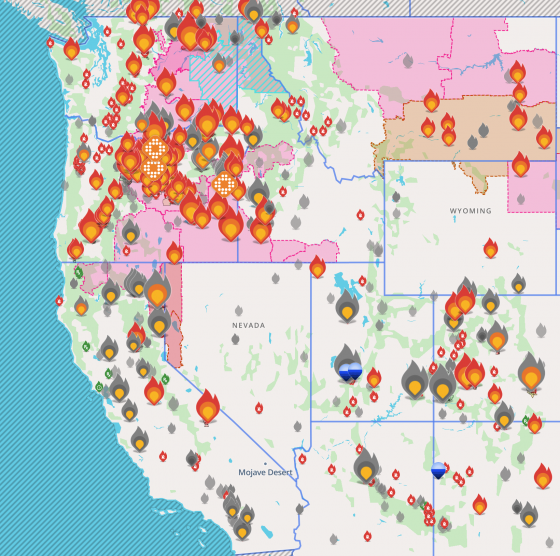
This is what the western third of the nation looks like right now.
Meanwhile, absolutely gigantic wildfires are ripping across France and Spain…
France fought an “unpredictable” wildfire close to Bordeaux on Sunday while Spain warned of “difficult hours” in its own fiery battle, with evacuations from danger zones in both countries mounting to well over 300,000 people.
The forest infernos, raging for days unchecked in France’s southwest and in central Spain near Madrid, were among the worst each nation has seen in peacetime.
France’s major fire has caused an unprecedented “pyrocumulonimbus”: a gigantic, untamable fire cloud that creates its own winds and packs lightning that causes more blazes, according to the National Firefighters Federation of France (FNSPF).
“It’s a David-versus-Goliath scenario: the idea is that, at some point, we’ll find a weak spot and strike there,” said FNSPF spokesman Eric Brocardi.
This sort of thing is not supposed to happen in Western Europe.
At this point, more than 250,000 people have been evacuated in just one region of France alone…
Authorities in France’s Gironde region, where the wine region city of Bordeaux is located, issued overnight evacuation orders for five more localities as shifting winds and arid conditions complicated the massive effort to limit the spread of the monster blaze. The evacuation operation now ranks among the biggest seen since World War II, authorities said, with more than 250,000 people ordered out of the danger zone in one region alone.
Of course it isn’t just the United States and Europe that are suffering.
In Japan, high temperatures reached at least 104 degrees for a fifth day in a row yesterday.
That is the longest streak in the entire recorded history of Japan…
Japan experienced its fifth consecutive day with temperatures reaching 40°C (104°F) or higher on July 25, setting the country’s longest such streak on record. The Japan Meteorological Agency (JMA) attributed the persistent heat to a Pacific high-pressure system that has kept skies largely clear across much of the country.
The highest temperature of the day was 40.8°C (105.4°F) in Mino, Gifu Prefecture. Other locations reaching 40°C (104°F) or higher included Tajimi, Gifu Prefecture at 40.7°C (105.3°F), Kuwana, Mie Prefecture at 40.6°C (105.1°F), Hamamatsu (Chuo Ward), Shizuoka Prefecture at 40.3°C (104.5°F), Toyota, Aichi Prefecture at 40°C (104.0°F), and Kofu, Yamanashi Prefecture at 40°C (104.0°F).
Whenever El Niño conditions develop we get hotter weather, and many parts of the globe also experience severe drought.
Right now, farmers and ranchers all over the Western Plains are dealing with a severe drought that is unlike anything they have ever experienced before…
The drought gripping the Western Plains is rapidly becoming one of the most devastating agricultural disasters producers have faced in decades. From southern Colorado to Montana, farmers and ranchers are battling a crisis that extends far beyond dry fields. Water supplies are dwindling, wheat crops are failing, hay production is shrinking and cattle producers are being forced into difficult herd liquidation decisions.
As a result of the extremely dry conditions, the water level in Lake Powell has fallen to a critically low level…
Lake Powell was 23.4% full on July 19. It was last full in 1983. If its level falls more, that could create environmental catastrophe by stopping the river flowing through the Grand Canyon, a situation known as “dead pool.”
The crisis could create ripple effects nationwide. Nearly half of the country’s vegetables and more than three-quarters of its fruits and nuts are grown in California, according to the state’s Food and Agriculture Department. A substantial amount of California crops are irrigated with Colorado River water.
When there is not enough water to irrigate crops in California any longer, we will be in all sorts of trouble.
Because this is a slow-motion disaster, a lot of people aren’t taking it very seriously.
But if you are old enough, you should still be able to remember the mass starvation that occurred in Africa as a result of the Super El Niño of 1982-1983.
This Super El Niño is going to be far stronger than that Super El Niño, and many are projecting that it will not end until well into 2027.
That means that this Super El Niño could affect global agricultural production for multiple years.
Of course this is happening at a time when we are also facing a global energy crisis and a global fertilizer crisis.
The stage has been set for a historic worldwide food supply crunch, and the poorest countries are going to get hit harder than anyone else.
Michael’s new book entitled “10 Prophetic Events That Are Coming Next” is available in paperback and for the Kindle on Amazon.com, and you can subscribe to his Substack newsletter at michaeltsnyder.substack.com.

About the Author: Michael Snyder’s new book entitled “10 Prophetic Events That Are Coming Next” is available in paperback and for the Kindle on Amazon.com. He has also written nine other books that are available on Amazon.com including “Chaos”, “End Times”, “7 Year Apocalypse”, “Lost Prophecies Of The Future Of America”, “The Beginning Of The End”, and “Living A Life That Really Matters”. When you purchase any of Michael’s books you help to support the work that he is doing. You can also get his articles by email as soon as he publishes them by subscribing to his Substack newsletter. Michael has published thousands of articles on The Economic Collapse Blog, End Of The American Dream and The Most Important News, and he always freely and happily allows others to republish those articles on their own websites. These are such troubled times, and people need hope. John 3:16 tells us about the hope that God has given us through Jesus Christ: “For God so loved the world, that he gave his only begotten Son, that whosoever believeth in him should not perish, but have everlasting life.” If you have not already done so, we strongly urge you to invite Jesus Christ to be your Lord and Savior today.